Introduction to geoanalytics
Geoanalytics in Synerise allow users to analyze events in the context of the location where they occurred. A single geoanalysis is created on the basis of the start.session event. This event gathers longitude and latitude parameters based on the IP addresses. On the basis of such an analysis, you can adjust communication and marketing strategies to the location of your customers.
Business benefits
You can also better leverage the increasing volume of location-related data. Thanks to this, an extended analysis of customer data will allow you to make better decisions that will help you boost your revenue.
- Better decisions related to marketing strategy that relies on location.
- The ability to check how many of your customers are in a specific region.
- The ability to estimate which region is best for a promotion for a specific product.
- The possibility of identifying customers from a specific region and sending them specific personalized messages.
Requirements
A tracking code implemented into the website.
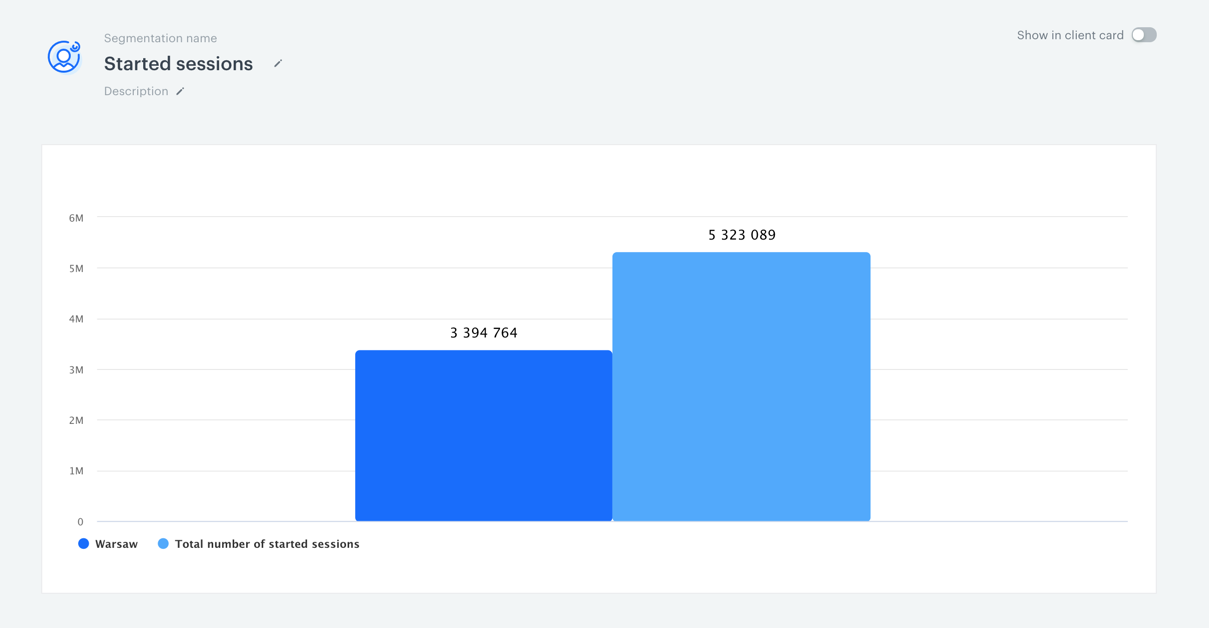
Geoanalysis example